

Mapping it out!
Since returning to school in Year 2 we have been building on our knowledge of what maps are and their purpose as well as developing some new map skills. We thought we would share some of our fantastic learning linked to maps!
We have learnt that maps are very useful and there are many different kinds of maps such as street and road maps, tube maps and even treasure maps!


The children learnt what an aerial view is, looking at different photos of famous places, discussing what the aerial perspective looked like. We then worked together to create our own aerial plans of our classrooms using shapes.
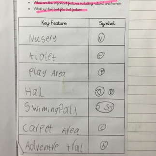
We walked around our school grounds, we took photos and talked about the position of some of the key buildings and features of our school environment. We then worked together in groups to make maps of the school grounds. Once we had done this we independently created our own maps of the school grounds where we added symbols and a key.


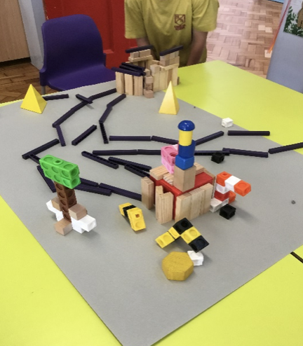
We then used the skills we had learnt to design a map of the woods from the story ‘Hansel and Gretel’. We thought about the route from their house to the Gingerbread House and the physical and human features they might pass on the way, that might be in the woods.
Using our designs and ideas of our Hansel and Gretel maps we then worked in small groups to create 3D versions using bricks and Lego.


Some of our fantastic 3D maps of the Woods from Hansel and Gretel. We worked so well in our teams!


Comments